Stelling Minnis Common - Grazing by Cattle
Links: Minnis Managers
Location
of cattle can be identified by the position of the water bowser.
The advisory
signs marking the boundaries of the are currently being grazed are no longer placed out.
2026
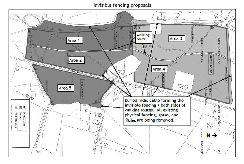
Note: The invisible fencing layout is under revision, the plan below will be replaced when an updated version has been received from the Managers of Stelling Minnis Common.
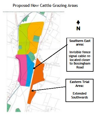
Changes include enlarged areas, extension South to Minnis Lane and North to just into the woods; the rings now overlap over the walkking route.
Further extension Southwards from areas 1 & 2 to Minnis Lane
© Crown copyright and
database rights 2017 Ordnance Survey licence number 100051856
In 2018 the areas to be grazed by cattle was revised, as shown on the map below
In 2021 new area 6 was added Between Areas 1 & 2 and Minnis Lane
© Crown copyright and
database rights 2017 Ordnance Survey licence number 100051856
The contents of this page is not the direct responsibility of Stelling Minnis Parish Council; it is provided as a community service.
Page designed and produced for Stelling Minnis Parish Council by Nick Smith - 5 May 2017
Revised 9 May 2026
Web site url and hosting facilities kindly donated by Simon Wood of Terabyte Computing Ltd